Trestle Tours
Trestle Tours are guided, self-driven tours of the old railroad lines in the Truckee/Tahoe area. On the tours, you’ll see old railroad grades, ties, rail, logging camp sites, collapsed trestles and other artifacts. At each stop, your guide will explain what we know about railroad operations in that area and its historical significance. At some stops, there are short hikes along the old railroad grades. Mostly it is an enjoyable few hours in the beautiful Truckee area, exploring and talking about railroads, logging, and local history.
Trestle Tours are free, but donations are greatly appreciated and pre-registration is required.
We have three tours planned for 2026. To sign up for any of them, please click the sign-up links, or email us at tours@tdrrs.org.
Hobart Estates Driving and Hiking Tour
Sunday, June 28, 2026
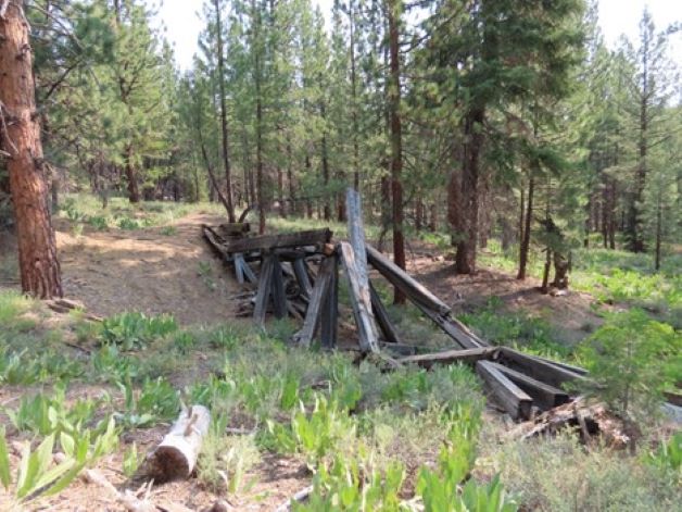
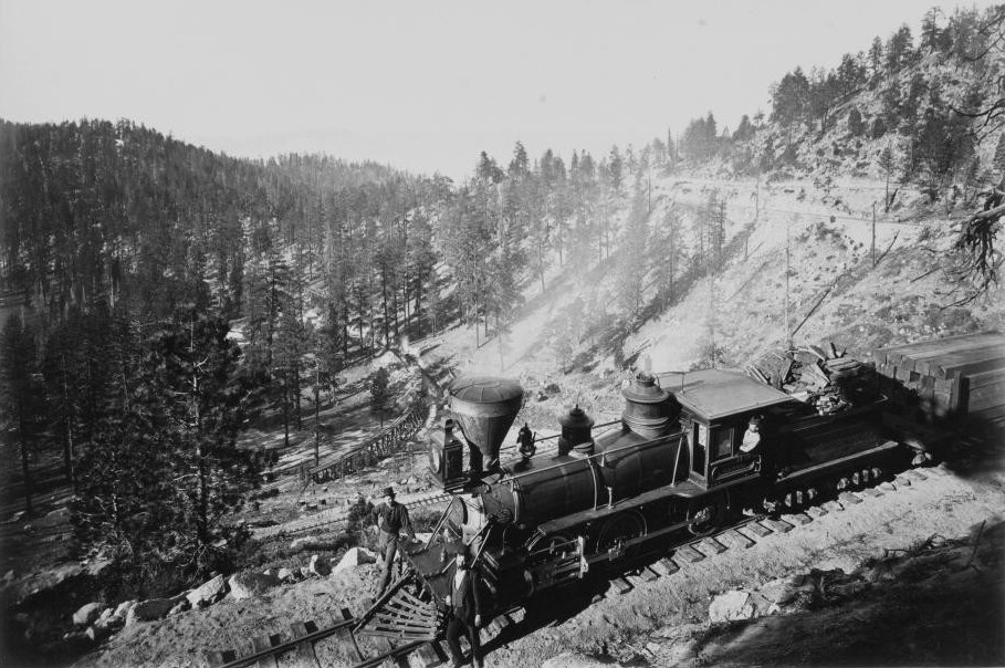
The Sierra Nevada Wood & Lumber Company, later known as Hobart Estate, operated a company mill town called Hobart Mills north of Truckee from 1900 to 1936 and logged thousands of acres in the Little Truckee River drainage. The company built a network of narrow-gauge rail lines to move cut logs from the forests to the mills, and a standard-gauge railroad called the Hobart Southern to transport lumber from the mill to the transcontinental railroad at Truckee.
This tour starts at Hobart Mills for an overview of the SNW&L / Hobart Estate lumbering operation and moves on to more remote areas where logs were loaded and transported to the mill. One of the stops includes a hike of about 2 miles (round trip) to see several fallen trestles.
This is a "self-driven" adventure, with a mix of paved and gravel/dirt roads. A 4WD or AWD high-clearance vehicle is recommended, but we won’t drive on anything not easily navigable by a Subaru. We recommend comfortable, layered clothing and sturdy shoes or boots. Bring sunglasses, hat, water, camera or smart phone, snacks, and lunch. Food will not be provided, but there will be a lunch stop. We will distribute a map and will have copies of old photos to examine while we travel.
We will meet and begin the tour at 9:00 AM in the parking lot for the Emigrant Trail - Hobart Mills Trailhead, just off Highway 89 on Hobart Mills Road. The tour usually takes 4 to 5 hours.
To sign up for this tour and receive more detailed directions to the meeting place, please click the link below.
Donner Summit
Saturday, August 29, 2026
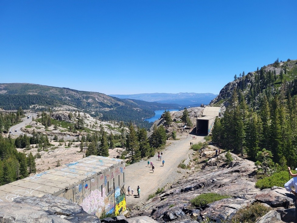
Tunnel 6 was the engineering marvel of the 19th Century; the longest and highest of the 15 tunnels of the transcontinental railroad as it crossed the Sierra. It was drilled through solid granite with hand tools over two years with progress of only inches per day.
We will lead a walking tour of Donner Summit railroad sites, including Tunnel 6, the new National Historic Landmark Summit Camp, China Wall, Summit station, the Lincoln Highway underpass, and the Dutch Flat-Donner Lake Wagon Road. We’ll share historical accounts about snowplows, non-native catfish, nitroglycerin, and blindfolded mules. We’ll also see the Summit Tunnel plaques placed by the National Railway Historical Society (NRHS) and National Historic Civil Engineering (ASCE) in 2025, and the view from the most inspirational square yard in the most historically significant square mile in the West.
The tour starts at 9 AM at the Lamson-Cashion Donner Summit Hub on Old Highway 40 (aka Donner Pass Road). As with the other tours, you’ll want layered clothing, sturdy shoes or boots, sunglasses, hat, water, flashlight, camera or smartphone, and a snack. We don’t expect this tour to run past lunch time, but you never know.
To sign up for this tour and receive more detailed directions to the meeting place, please click the link below.
Carson & Tahoe Lumber & Fluming Company (railroad from Glenbrook to Spooner Summit)
Saturday, September 26, 2026
The Carson and Tahoe Lumber and Fluming Company (C&TL&F) was one of the two major logging operations in the Tahoe basin during the heyday of the Comstock lode mining boom. From 1875 to 1898, the C&TL&F used four railroads and a V-flume to move logs and timbers from the Tahoe basin to Virginia City to be used to shore up underground mines and fuel the stamp mills.
On this tour, we will explore the C&TL&F grade and switchbacks in Slaughterhouse Canyon, the remnants of a tunnel at Spooner Summit, and the loading area for the Clear Creek flume. The driving part of this tour is on paved roads. The walking part includes 2-3 miles of hiking on old railroad grades with some rough ground. You’ll want to bring want layered clothing, sturdy shoes or boots, sunglasses, hat, water, camera or smart phone, and lunch or a snack. The tour will begin at 9:00 AM at the Skunk Harbor parking area on Highway 28 and will last 4-5 hours. There will be a lunch stop, possibly without bathrooms.
To sign up for this tour and receive more detailed directions to the meeting place, please click the link below.